Introduction: Where the Carpathians Call You
As you step onto the first Carpathians trails, you’ll feel the mountains whispering your name—their voice carried in the rustle of spruce trees and the gurgle of streams racing downhill. In 2025, these peaks in Transcarpathia are more than just nature; they’re a sanctuary where your soul finds peace and your body meets a challenge worthy of the grandest adventures. Picture this: you’re trekking a narrow path, the wind humming in your ears, while far below, Lake Synevyr glimmers like the eye of the Carpathians. I’ve watched travelers—novices clutching maps and seasoned pros with trekking poles—set foot on these trails, their eyes alight with wonder. You won’t resist the call echoing from the heart of these mountains either.
Top Routes: Where to Go in Transcarpathia
Hoverla: Ukraine’s Rooftop
Conquering Hoverla, Ukraine’s highest peak at 2,061 meters (ca. 6,762 feet), feels like standing at the edge of the world:
- Time: 5–7 hours round trip, with pauses to soak in the views.
- Start: Zaroslyak base, about 20 km from Rakhiv (approximate coordinates: 48.1603° N, 24.5503° E).
- Difficulty: Moderate—easy for pros, but novices need basic fitness.
- Highlights: Steep climbs reward you with a panorama stretching to Romania on clear days.
Your heart will pound in rhythm with the mountains, and in winter, these slopes transform into thrilling ski runs (check out the Ski Resorts of Rakhova and Yasiny). Newbies, grab a guide (+38 (096) 619 93 79 Ski, +38 (050) 088 81 84 Snowboard); pros, this is a Carpathian classic. For more on Ukraine’s highest peak, see Hoverla’s cultural significance from the Encyclopedia of Ukraine.
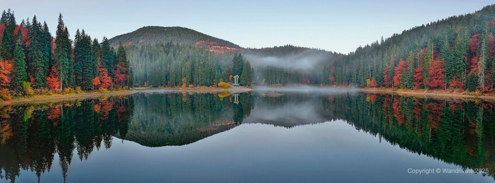
Synevyr: The Eye of the Carpathians
Reaching Lake Synevyr, you’ll sense its tranquil power:
- Time: 3–4 hours at a leisurely pace, perfect for families with kids aged 6+.
- Start: Synevyrska Polyana village (approximate coordinates: 48.6167° N, 23.6833° E).
- Difficulty: Easy—paved road to the viewpoint, then a gentle trail.
- Highlights: The lake’s stillness and the romantic legend of Syn and Vyr make it a soul-soothing escape (explore more at Lake Synevyr: Hiking Routes to the Heart of the Carpathians).
For beginners, it’s an ideal first trail; for pros, a warm-up before tougher treks. Learn about its ecological importance at Ukraine’s National Parks from the Ministry of Environmental Protection.
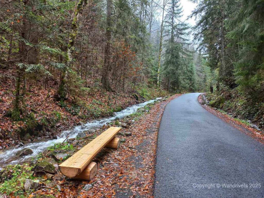
Yaremche: Waterfalls and Wanderlust
In Yaremche, nature comes alive with a lyrical pulse:
- Time: 2-3 hours to Probiy Waterfall, with stops for photos.
- Start: Yaremche town center, near the market (approximate coordinates: 48.4478° N, 24.5569° E).
- Difficulty: Easy—paved paths and trails safe for kids 5+ or older travelers.
- Highlights: The 8-meter Probiy Waterfall and the Prut River bridge reveal the Carpathians’ tender side (dive deeper at Yaremche: Tourist Center of the Hutsul Region).
I’ve seen families snapping pics here, and you’ll feel the water’s roar melt away city stress. For Hutsul cultural context, visit Hutsul Heritage on Britannica.
Alternative Trails: More Carpathian Magic
Craving variety? Try these:
- Pip Ivan Chornohirskyi: 2,028 meters, 8–10 hours from Dzembronya, high difficulty—for seasoned hikers only.
- Borzhava Polonyna: 4–6 hours from Volovets, moderate difficulty—sweeping views and wild berries in August (see Summer Transcarpathia: Secrets of the Season and Climate).
Safety on the Trails in 2025
Natural Challenges
The Carpathians in summer and fall are stunning but sneaky:
- Weather: Sudden rains (July averages 15 mm/hour) and fog (visibility down to 10 meters)—download a weather app like Meteo.gov.ua and pack a raincoat.
- Trails: Skip remote routes without GPS or a guide—paths get slippery, and it’s easy to lose your way.
- Emergency: Transcarpathia Rescue Service—dial 101 if you’re in trouble.
War’s Distant Echoes
In 2025, Transcarpathia remains untouched by conflict:
- Sirens: Rare (once every 1–2 weeks)—keep the “Air Alert” app handy. Shelters are available in Yaremche (near the bus station) and Rakhiv (central square).
I’ve seen travelers roam these trails with ease, and with these tips, you’ll stride with confidence.
Getting to the Starting Points
From Kyiv to the Carpathians:
- Train: Kyiv to Yaremche—350 UAH ($8.75), 14 hours, book via Ukrzaliznytsia.
- Bus: Kyiv to Rakhiv—600 UAH ($15), 13 hours; check FlixBus.
From Yaremche to Synevyr, a bus costs 100 UAH ($2.50, 2 hours); from Rakhiv to Zaroslyak, a taxi is 200 UAH ($5). For full logistics, see The Road from Kyiv to Transcarpathia: Your 2025 Travel Guide.
Practical Tips for Travelers
Gear up for the Carpathians:
- Clothing: Waterproof trekking gear and a warm fleece—mountain temps drop to 15 °C (59 °F) even in summer.
- Equipment: Trekking poles (from 300 UAH, $7.50 in Yaremche), Maps.me for novices, GPS with a spare battery for pros.
- Food: Pack sandwiches and nuts for the day, plus 1.5 liters of water per person—springs aren’t always safe.
Guides for tough routes like Hoverla? Contact locals like “Carpathian Trails” in Yaremche (+38 (098) 568 568 5, or Google “Hoverla hike with a Hutsul”).
Note: when a Hutsul says, “it’s close,” it could mean 3 to 20 km—distance is poetic here! Families stick to Synevyr or Yaremche; pros, chase the adrenaline of Hoverla or Borzhava.
Epilogue: Trails That Hold Your Soul
Once you’ve walked these paths, the Carpathians will claim a piece of you—their whisper in the spruce, their strength in every step, their beauty in every glance at Synevyr or Hoverla. I’ve seen travelers, from first-timers tasting mountain air to veterans knowing every twist, return again and again. You won’t resist these peaks that feel like a second home, calling you back with a wild, romantic pull.